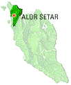
Kelantan is positioned in the north-east of Peninsular Malaysia. It is bordered by Narathiwat Province of Thailandto the north, Terengganu to the south-east, Perak to the west, and Pahang to the south. To the north-east of Kelantan is the South China Sea.
Kelantan is located in the north-eastern corner of the peninsula, Kelantan, which is said to translate as the "Land of Lightning" (see alternate theories below), is an agrarian state with lush paddy fields, rustic fishing villages andcasuarina-lined beaches. Kelantan is home to some of the most ancient archaeological discoveries in Malaysia, including several prehistoric aboriginal settlements.
Due to Kelantan's relative isolation and largely rural lifestyle, Kelantanese culture differs somewhat from Malay culture in the rest of the peninsula; this is reflected in the cuisine, arts, and the peculiar Kelantanese Malaydialect, which is unintelligible even for some speakers of standard Malay
 .
.
HISTORY OF KELANTAN
The name Kelantan is said, by Mohd Rosli Bin Ismail (Great Historian), to be a corruption of gelam hutan, i.e. the Malay word for the cajuput, or swamp tea tree (Melaleuca leucadendron). Other theories claim the name comes from the Malay word kilatan, 'shiny/glittery' or kolam tanah, 'clay pool'. Kelantan was calledKalantan (Thai: กลันตัน) by the Siamese when it was under their influence.
Another occasionally quoted hypothesis is that 'Kelantan' derived originally from the Indian 'Kolaan Thana' or 'Kolaam Thana', which meant 'Land of Kolaan' or 'Land of Kolaam', the term 'kolaan' or 'kolaam' referring to the floor paintings/diagrams in the numerous Hindu temples which dotted the land in the very ancient days. 'Kolaan Thana' or 'Kolaam Thana' gradually became 'Kelantan' to fit in better with the speaking dialect of the local people.
The early history of Kelantan traces distinct human settlement dating back to prehistoric times. Early Kelantan had links to the Funan Kingdom, the Khmer Empire,Sri Vijaya, Majapahit and Siam[citation needed]. Around 1411, Raja Kumar, the ruler of Kelantan, became independent of Siam, and Kelantan became an important centre of trade by the end of the 15th century.
In 1499, Kelantan became a vassal state of the Malacca Sultanate. With the fall of Malacca in 1511, Kelantan was divided up and ruled by petty chieftains, paying tribute to Patani, then the supreme Malay Kingdom of the eastern peninsula. By the early 17th century, most of these Kelantan chiefs became subject to Patani.
Around 1760, Long Yunus, an aristocratic warlord of Patani origin succeeded in unifying the territory of present-day Kelantan and enthroned by his father-in-law Ku Tanang Wangsa, Regent of Terengganu as Yang di-Pertuan Muda or Deputy Ruler of Kelantan. Long Yunus was succeeded in 1795 by his son-in-law Tengku Muhammad Sultan Mansur Terengganu. The enthronement of Tengku Muhammad by Terengganu fraction were not content by Long Yunus sons, thus triggering a war against Terengganu by Long Muhammad, the eldest son of Long Yunus. Terengganu fraction are defeated in 1800 and Long Muhammad ruled Kelantan with the new title of Sultan as Sultan Muhammad I. The death of childless Long Muhammad triggered a civil war among claimants to the throne. His nephew and son of Long Tan (Temengggong), Long Senik Mulut Merah, triumphed over his uncles and cousins and assumed the throne in 1835 as Sultan Muhammad II.
Sultan Muhammad II leveraged on his loose alliance with Siam to form the modern Kelantan state centered in his new fort (Kota Bharu) on the eastern bank of the Kelantan river.
Under the terms of the Anglo-Siamese Treaty of 1909, the Thais relinquished its claims over Kelantan, Terengganu, Kedah and Perlis to Great Britain, and Kelantan thus became one of the Unfederated Malay States with a British Adviser.
Kelantan was the first place in Malaya to be occupied by the Japanese, who invaded on December 8, 1941. During the Japanese occupation, Kelantan came again under control of Siam, but after the defeat of Japan in August 1945, Kelantan reverted to British rule.
Kelantan became part of the Federation of Malaya on February 1, 1948, and together with other Malayan states attained independence on August 31, 1957. On September 16, 1963, Kelantan became one of the states of Malaysia.
kELANTAN LOCAL FOOD
All this food you mst try:-

- Laksa Kelantan
- Nasi Dagang
- kerabu
- Nasi Tumpang
- Ayam Percik
- Nasi Berlauk
- Nasi Ulam
- Keropok lekor